 Algorithm Overland

AO:Land Convoy & Off-Road
This link opens in the AO:Land app. Don't have it yet? It's free on the App Store.
Terrain navigation built for off-road, with route intelligence to keep you and your convoy moving confidently in the backcountry.

Free · iOS
Already have it? Open AO:Land
Don't use it while driving; set your route before you move. Routes may cross closed or private land, so carry backup navigation.
All AO apps · Privacy · Terms · Cookie Settings
Apple and the Apple logo are trademarks of Apple Inc., registered in the U.S. and other countries and regions. App Store is a service mark of Apple Inc.
The app
About AO:Land
Overland nav & offline maps
AO:Land is a free off-road navigation app for overlanders, off-roaders and remote explorers. It's built for the places where cell service drops out: download topographic, satellite and terrain maps before you leave, then navigate with no cell signal or data connection.
On the map you get off-road GPS routing on curated 4x4 tracks, overland trails and dirt roads across the United States, plus a public lands layer that shows BLM land, National Forest, National Park and state land. Turn on hillshade, contour lines or 3D terrain, and mark campsites, water sources, obstacles and viewpoints with custom pins and exact GPS coordinates.
AO:Land is also a convoy tool. Send one invite link in WhatsApp, Messages or any chat, or show a QR code, and your whole group shares a live trail map with each vehicle's position, speed and direction, so no one gets left behind. The link opens straight in AO:Land, or shows a download page to friends who don't have it yet. You can rejoin a convoy after the app closes, and leave cleanly even with no signal.
AO:Land is free, with no paywalls. GPS running in the background can drain your battery faster, so carry physical backup maps and use your own judgment on the trail.
- PriceFree
- CategoryNavigation
- RequiresiOS 17.0+
- DevicesiPhone, iPad, Apple Watch
- Age4+
Features
AO:Land features
Offline trail maps
Download topo, satellite and terrain maps and navigate with no signal.
Off-road GPS routing
Curated 4x4 tracks, overland trails and dirt roads across the US.
Public lands layer
See BLM land, National Forest, National Park and state land on the map.
Terrain views
Hillshade, contour lines and 3D terrain from USGS elevation data.
Custom waypoints
Pin campsites, water, obstacles and viewpoints with exact coordinates.
Live convoy tracking
See your group's positions, speeds and directions on your map.
Invite by link or QR
Send one link in WhatsApp, Messages or any chat, or show a QR code.
Rejoin and leave
Rejoin after the app closes, and leave cleanly even with no signal.
Screenshots
AO:Land on iPhone
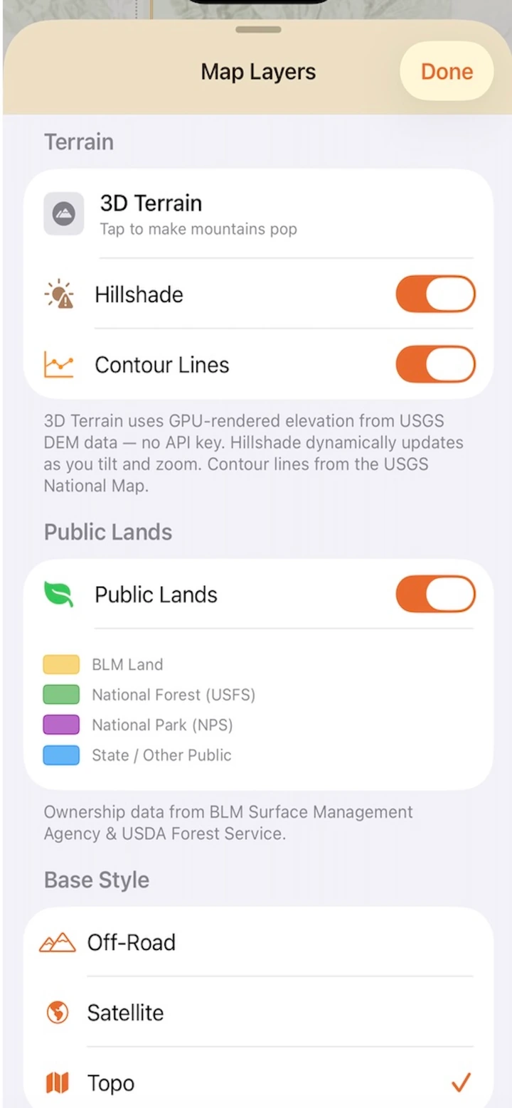
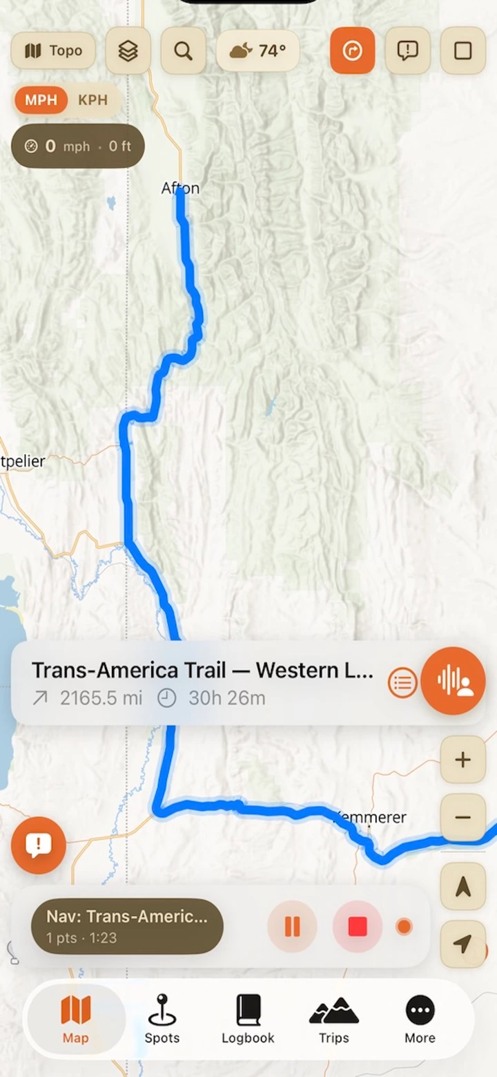
Screens from the AO:Land App Store listing.
The system
How AO:Land fits the Algorithm Overland system
AO:Land is one of five free Algorithm Overland apps, made to go along with gear like the Algorithm Overland Kitchen Cube on backcountry routes.


FAQ
AO:Land questions
Is AO:Land free?
Yes. AO:Land is free on the App Store, with no paywalls.
Does AO:Land work offline?
Yes. Download topographic, satellite and terrain maps before you leave, then navigate with no cell service or data connection. You can also leave a convoy cleanly with no signal.
How do I invite my convoy?
Send the invite link in WhatsApp, Messages or any chat, or show the QR code from the Invite button on the convoy screen. The link opens straight in AO:Land, or shows a download page to friends who don't have it yet.
Which devices does AO:Land run on?
iPhone with iOS 17.0 or later and iPad with iPadOS 17.0 or later. The App Store also lists Apple Watch (watchOS 10.0 or later).
Does AO:Land use my location in the background?
It may use your location even when it isn't open, which can decrease battery life. Always carry physical backup maps.
Get AO:Land
Free · iPhone, iPad and Apple Watch · iOS 17.0 or later